
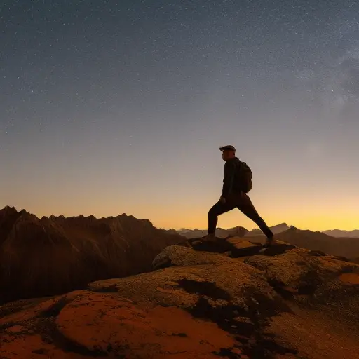
In the vast expanse of the wilderness, the ability to navigate becomes paramount. While modern technology offers convenience, it is crucial to possess the knowledge and skills to navigate using the stars, sun, and natural landmarks.
This article delves into the art of wilderness navigation, providing practical insights on celestial navigation, utilizing stars as guides, harnessing the power of the sun, and relying on natural landmarks to find one’s way.
Equip yourself with essential tools and embark on a journey of exploration and self-reliance in the wild.
The Importance of Wilderness Navigation
The ability to navigate in the wilderness is crucial for outdoor enthusiasts and adventurers alike. In the vast expanse of nature, getting lost can lead to dire consequences. That’s why mastering wilderness navigation is an essential skill for anyone venturing into unknown terrain.
It is not enough to rely solely on GPS devices or technology, as they can fail or run out of battery. Instead, understanding orienteering techniques and relying on natural cues is vital for wilderness survival.
Orienteering techniques involve using a compass, map, and natural landmarks to determine one’s position and direction. By familiarizing oneself with the surrounding landscape, adventurers can identify prominent features such as mountains, rivers, or distinctive trees that can serve as reliable reference points. Additionally, understanding how to read the stars and the sun can provide valuable information for navigation when traditional tools are not available.
In the wilderness, being able to navigate effectively can mean the difference between life and death. It allows adventurers to find their way back to civilization, locate water sources, or avoid dangerous areas. Furthermore, mastering wilderness navigation enhances self-reliance and fosters a deeper connection with the natural world.
Understanding Celestial Navigation
Understanding celestial navigation is crucial when navigating in the wilderness. One of the key points to grasp is finding true north, as it serves as a reference point for determining direction.
Using constellations as guides can help travelers navigate at night when other landmarks are not visible.
Accurate measurements are essential for successful celestial navigation, as even a slight miscalculation can lead to significant errors in determining one’s position.
Finding True North
By understanding the principles of celestial navigation, one can effectively find true north using the stars, sun, and natural landmarks.
While a compass is a reliable tool for navigation, it is important to account for magnetic declination. Magnetic declination refers to the difference between magnetic north and true north. This variation can be significant in certain areas, leading to inaccurate readings if not taken into consideration.
To find true north using celestial navigation, one can rely on the stars. The North Star, or Polaris, is a fixed point in the sky that aligns with the Earth’s axis. By finding Polaris and marking its position, one can determine true north.
This understanding of celestial navigation provides a foundation for using constellations as guides in finding direction in the wild.
Using Constellations as Guides
Constellations serve as reliable guides in celestial navigation, providing a quantitative basis for determining direction in the wild. Ancient navigation techniques relied heavily on celestial maps and the patterns formed by constellations.
Here are three ways in which constellations can be used as guides:
-
Identifying cardinal directions: By locating certain constellations, such as the North Star or the Southern Cross, navigators can determine north, south, east, and west, even without a compass.
-
Tracking time and season: The position of constellations in the night sky changes throughout the year. By observing their movement, navigators can estimate the time of night or the season, aiding in navigation.
-
Creating reference points: Constellations can serve as fixed reference points in the sky, allowing navigators to establish their position and course by comparing the positions of different constellations.
Importance of Accurate Measurements
Accurate measurements are essential in the practice of celestial navigation, as they provide precise information for determining one’s position and course in the wild.
In celestial navigation, accurate measurements of celestial bodies such as stars and the sun are crucial for determining latitude and longitude. Astronomical instruments like sextants are used to measure the angle between the celestial body and the horizon. By comparing this angle with the known positions of celestial bodies at a given time, navigators can calculate their position.
Additionally, accurate timekeeping is crucial in celestial navigation, as it allows for accurate calculations of celestial positions.
Without accurate measurements, celestial navigation would be unreliable and potentially dangerous. Therefore, ensuring accurate measurements is of utmost importance in celestial navigation to ensure safe and successful navigation in the wild.
Using Stars to Find Your Way
When navigating using stars, it is important to understand the basics of star navigation. This includes learning how to identify constellations that can serve as guides and using the North Star as a reliable reference point.
Star Navigation Basics
Star navigation is a reliable method of finding one’s way in the wild. By using the position and movement of stars in the night sky, one can determine their direction and navigate accurately.
Here are three star navigation techniques that can be used:
-
Identifying the North Star (Polaris): The North Star is a fixed point in the sky that aligns with the Earth’s axis. By locating the North Star, one can determine their north direction.
-
Using constellations: Constellations are groups of stars that form recognizable patterns. By identifying specific constellations and their positions, one can navigate based on their known orientations.
-
Observing star trails: As the Earth rotates, stars appear to move in a circular path. By observing the movement of stars over time, one can determine their direction of travel.
These celestial navigation methods can be invaluable in the wild, providing a reliable means of finding one’s way without the need for modern technology.
Identifying Constellations for Guidance
Continuing from the previous subtopic, an effective method of star navigation in the wild involves identifying constellations to guide one’s way. Constellations are groups of stars that form recognizable patterns in the night sky. For beginners, it may seem overwhelming to identify constellations, but with practice and the right tools, it can become an invaluable skill. Ancient navigation techniques relied heavily on constellations for direction, and many of these methods are still relevant today. To help you get started, here is a table showcasing four popular constellations, their names, and their distinctive shapes:
| Constellation | Name | Distinctive Shape |
|---|---|---|
| Ursa Major | Big Dipper | Ladle |
| Orion | Orion’s Belt | Three aligned stars |
| Cassiopeia | Queen’s Chair | W or M shape |
| Cygnus | Northern Cross | Cross shape |
Using the North Star
To further enhance your star navigation skills, we will now delve into the significance of the North Star in celestial navigation. When navigating without a compass, the North Star, also known as Polaris, becomes a reliable guide. Here’s how to use it for direction:
-
Locate the Big Dipper: The North Star is found at the end of the handle of the Big Dipper constellation. Imagine a line extending from the two stars at the end of the Dipper’s bowl, and it will lead you to Polaris.
-
Determine true north: Once you have located the North Star, you can determine true north by drawing an imaginary line from Polaris to the horizon. This line points directly to the North Pole.
-
Navigate using Polaris: By identifying the North Star and determining true north, you can use Polaris as a reference point to orient yourself and navigate accurately, even without a compass.
With the knowledge of using the North Star for direction, you can confidently navigate the wilderness using the stars as your guide.
Harnessing the Power of the Sun
By utilizing the energy emitted by the sun, individuals can navigate the wild with precision and efficiency. Harnessing solar energy has become an increasingly popular method for powering various devices and systems. In the context of wilderness navigation, solar power offers several benefits that make it a valuable resource.
One of the key advantages of harnessing solar energy is its sustainability. Unlike fossil fuels, which are finite and contribute to environmental degradation, solar power is a renewable resource that does not produce harmful emissions. This makes it a cleaner and more eco-friendly option for individuals exploring the wild.
Solar power also provides a reliable source of energy, especially during extended periods in the wilderness. By utilizing solar panels or portable solar chargers, adventurers can recharge their electronic devices, such as GPS devices, satellite phones, and cameras. This ensures that these essential tools remain functional and ready for use, even in remote locations.
In addition to powering electronic devices, solar energy can also be used to heat water or cook food. Solar-powered water heaters and portable solar cookers are lightweight, compact, and easy to use, making them ideal for outdoor enthusiasts. These devices rely on the sun’s rays to generate heat, eliminating the need for bulky fuel canisters or the risk of running out of fuel.
Harnessing the power of the sun offers numerous benefits when navigating the wild. Its sustainability, reliability, and versatility make solar energy an invaluable resource for adventurers seeking to explore nature while minimizing their environmental impact.
Navigating With Natural Landmarks
Utilizing natural landmarks, adventurers can effectively navigate the wild with precision and confidence. By employing orienteering techniques, they can rely on the following natural landmarks to find their way:
-
Prominent Mountains: Majestic peaks act as reliable reference points, visible from miles away. By studying the shape and contours of these mountains, adventurers can determine their location and plot a course.
-
Distinctive Rock Formations: Unique rock formations, such as towering cliffs or natural arches, provide distinct landmarks that stand out in the vast wilderness. These formations can serve as reliable indicators of direction or as checkpoints along a planned route.
-
River Systems: Rivers and streams can act as natural highways, leading adventurers to their desired destination. By following the flow of water, they can navigate through dense forests or rugged terrain, while also using the riverbanks as reference points.
When relying on natural landmarks, it is essential to combine observations with orienteering skills. Adventurers must learn to read topographic maps, understand compass navigation, and take note of their surroundings.
Essential Tools for Wilderness Navigation
A crucial aspect of wilderness navigation involves employing key tools to ensure accurate and reliable guidance. These tools are essential for wilderness survival and enable adventurers to navigate through unfamiliar terrain.
One of the most important tools is a compass, which provides a reliable method of determining direction. By aligning the compass needle with the Earth’s magnetic field, hikers can accurately determine their heading, allowing them to stay on course.
Another indispensable tool is a topographic map, which provides a detailed representation of the surrounding area. These maps include contour lines, elevations, and landmarks that aid in orienteering techniques. They allow adventurers to plan their routes, identify potential obstacles, and locate water sources and shelter. It is important to ensure that the map is up-to-date and accurate for the specific region.
Additionally, a GPS device can be a valuable tool in wilderness navigation. These devices use satellite signals to determine the user’s precise location and can provide real-time tracking and route planning. However, it is important to note that GPS devices can be unreliable in dense forests or mountainous areas with limited satellite coverage. Therefore, it is essential to have alternative navigation methods and tools as backup.
Frequently Asked Questions
How Do I Determine My Exact Location Using Celestial Navigation?
Determining latitude and longitude using celestial navigation involves observing celestial bodies, such as the stars, to calculate one’s position on Earth. By identifying specific constellations, mariners and explorers can navigate accurately even without modern technology.
What Are Some Common Mistakes to Avoid When Using Stars for Navigation?
When using stars for navigation, it is important to avoid common mistakes such as relying on a single star, neglecting to account for atmospheric conditions, and failing to update celestial data regularly. By understanding these tips and tricks, one can overcome misconceptions about celestial navigation.
Can I Navigate Solely Using the Sun During the Night?
Navigating without stars, one can still employ alternative methods for night navigation. While the sun is not visible during the night, other celestial bodies such as the moon and planets can offer guidance. Additionally, using natural landmarks can be valuable for orienteering.
How Can I Accurately Measure Time Using the Position of the Sun?
Accurately measuring time using the position of the sun requires understanding sundial accuracy and solar noon calculation. By utilizing these techniques, one can navigate the wild with precision and ensure efficient time management.
What Are Some Natural Landmarks That Can Help Me Navigate in the Wilderness?
Natural landmarks such as mountains, rivers, and distinctive rock formations can be valuable resources for wilderness navigation. By studying topography and understanding the terrain, adventurers can use these landmarks as reference points to navigate with greater accuracy.
Conclusion
In the vast wilderness, where modern technology may fail, the ancient art of celestial navigation and the guidance of natural landmarks become invaluable. By understanding the stars and the sun, explorers can navigate their way with confidence, finding their path even in the darkest of nights.
These tools of wilderness navigation, along with an unwavering spirit of adventure, allow us to connect with nature on a deeper level, fostering a sense of awe and reverence for the world around us.